Partner's Data
OCS collaborates with a number of partners to enhance the types of data collected from OCS moorings. Links to the data from those partners will navigate you out of the OCS webpages.
PMEL Carbon Group
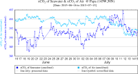
A MAPCO2 system, provided by the PMEL Carbon Group, measures the CO2 levels in the atmosphere just above the sea surface, and dissolved in the sea surface waters. For plots of the 30 day and long term records, please visit the PMEL Carbon Group pages for each specific site:
30 day and full data plots at KEO 30 day and full data plots at Papa
Carbon data records from the KEO and Papa sites are archived and made available through the National Centers for Environmental Information (NCEI). Carbon data from the ARC deployment are not yet available.
Additionally, PMEL's carbon group deploys ASVCO2 systems aboard the TPOS Saildrone missions directed by OCS. These data are accessible via the carbon group's webpage linked below (left), or through a direct link to the QC'd data stored at NCEI (right).
Buoys & Autonomous Systems Saildrone ASVCO2 Data (NCEI)
NDBC TPOS Mooring Enhancement Data
The NDBC Tropical Pacific Observing System (TPOS) mooring enhancement pilot project is described under a separate OCS webpage.
The NDBC Coastal Weather Buoy (CWB) enhancement pilot project is described on this OCS webpage.
Waverider at Papa
(University of Washington Applied Physics Lab)
A Waverider mooring has been deployed near the OCS Papa mooring since 2010. Wave height and wave period data from this mooring may be viewed through the CDIP website here. A sample plot is shown in the right sidebar.
Gas Tension and Dissolved Oxygen
(University of Washington School of Oceanography)
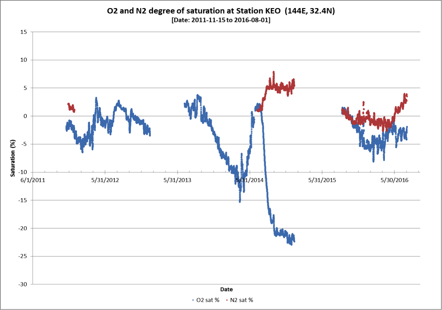
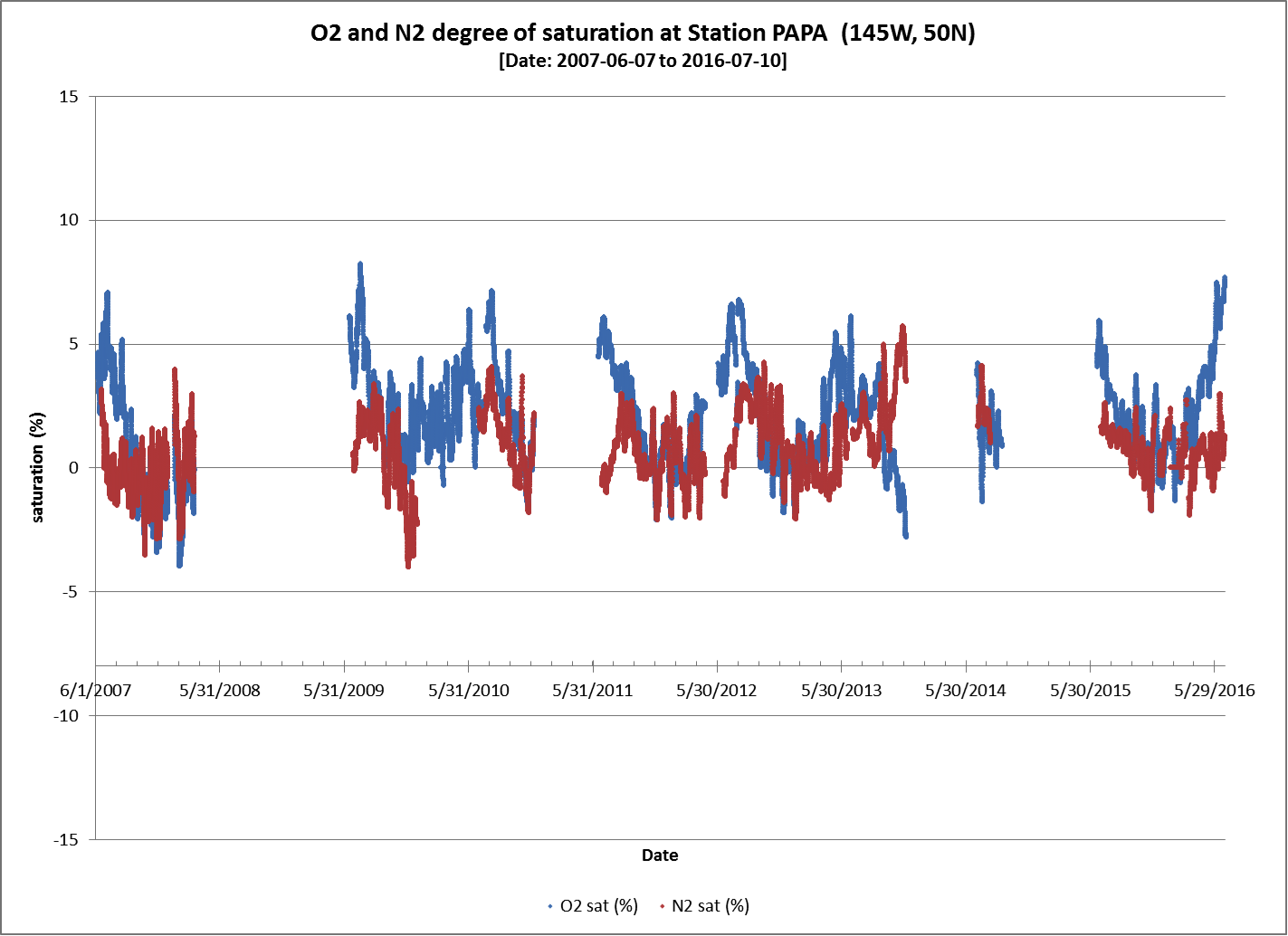
Gas tension and dissolved oxygen data from KEO and Papa are available through the NOAA OCADS website. Please contact Dr. Steve Emerson (emerson@washington.edu) with questions.
Data from KEO and Papa sites are available by clicking the appropriate site on the map here:
https://www.nodc.noaa.gov/ocads/oceans/Moorings/Pacific.html
Plots of available data from KEO (top) and Papa (bottom) are shown below. Click images to enlarge. (NOTE: Measurements at the KEO site were discontinued after the 2017 deployment.)
Seaglider at Papa
(University of Washington School of Oceanography)
Seaglider autonomous vehicles surveyed near the OCS Papa mooring during 2008-2010. Seagliders collected profiles of temperature, salinity, oxygen, backscatter, and fluorescence, along with estimates of depth-average currents, in the top 1000 m. Bin-average profiles, currents, and oxygen calibration data can be found at the UW Researchworks archive here. If you are a MATLAB user, code that illustrates how to download and plot these data can be found here. Profiles without bin-averaging can be found at the NODC (here, here, and here). Please contact Noel Pelland (nap2@u.washington.edu) with any questions.
If you use these data, please cite Pelland, Eriksen, and Cronin [2016] JGR. These data were funded by NSF grants OCE-0628663 and OCE-1129090.
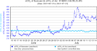
Sample plot of CO2 data from the KEO mooring. If the level in the atmosphere (light blue) is greater than in the ocean (dark blue), CO2 is being absorbed by the ocean. If reversed, CO2 is being emitted by the ocean into the air. See links at left for most recent data plots.
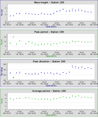
Sample plots of wave heights at Papa. Click link to examine the plot for this week.


