OCS Saildrone Mission - TPOS 2021
This mission is supported by NOAA OMAO, NOAA NOPP, and Saildrone, Inc.
Mission Overview
Mission Dates: July 23, 2021 - February 17, 2022
TPOS Mission 4 launched on July 23, 2021, with two Saildrone uncrewed surface vehicles (USV) departing from San Francisco Bay, CA, en route to the Eastern Tropical Pacific hurricane genesis region near 10°N - 15°N, 110°W. The saildrones entered the region during its convective season, which extends from early June through mid-October. While in the genesis region, the two drones made repeat sections to observe environmental preconditions and storm activity that can lead to hurricane development.
Hurricanes that develop in this region affect moisture transport and subsequent rainfall along the west coast of North America. The current array of tropical moorings does not extend to the Eastern Tropical Pacific Warm Pool, and therefore fails to resolve the air-sea interaction that can fuel these storms. Saildrone USVs not only have the ability to navigate this region but are capable of adaptive sampling to measure air-sea heat and momentum exchanges, and one drone will also be able to measure the air-sea carbon dioxide fluxes in this important undersampled region.
After spending approximately six weeks in the Eastern Tropical Pacific hurricane genesis region, the two drones transited southward across a strong frontal region to the cold waters of the equator at 110°W, where carbon dioxide tends to outgas, affecting global carbon budgets. The mission performed intercomparisons with moored buoys as navigational control allowed. In this region, models often have large biases affecting El Niño forecasts and the global hydrological cycle. These direct measurements of surface conditions and air-sea interactions will help identify the missing physics affecting these model biases.
This mission was funded in part by NOAA Office of Marine and Aviation Operations (OMAO), NOAA Global Ocean Monitoring and Observing (GOMO), and NOAA National Oceanographic Partnership Program (NOPP), which brings partners together from different NOAA line offices, universities, and industry, along with international partners from both Mexico and France.
Want more up-to-date information? You are in luck! Follow the drones on their 2021 TPOS journey and access real-time data on the PMEL Saildrone dashboard.
Hurricane Forecasts
Mission Blog
The Sun Sets on TPOS 2021
July 6, 2022
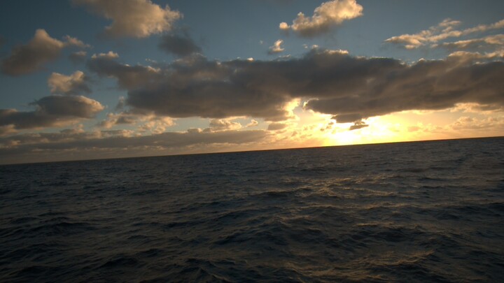
Photo taken on SD 1066 in the tropical Pacific Ocean. Photo credit: Saildrone, Inc.
After spending 160 days in the eastern tropical Pacific, SD1065 and SD1066 concluded their Tropical Pacific Observing System (TPOS) mission on February 17, 2022. At the completion of the 2021 TPOS mission, the drones were located in the vicinity of the equatorial study region, with SD1065 and SD1066 positioned near 8°S, 117°W and 1°N, 130°W, respectively.
Beginning around mid-November 2021, as SD1065 and SD1066 approached the 2°N, 110°W TAO buoy, the two drones encountered the northern edge of a tropical instability wave (TIW), characterized by a strong meridional sea surface temperature front separating the warmer waters of the Intertropical Convergence Zone (ITCZ) from the colder waters of the westward expanding equatorial Pacific Cold Tongue. After multiple attempts at crossing the front, the drones eventually drifted westward due to challenging conditions including strong equatorial currents and weak surface winds. However, despite the navigational difficulties, the drones were able to closely survey the strong frontal region over a ~7-day period, capturing critical information along the air-sea interface.
Following the passage of the TIW, the two drones struggled to transit back east toward the 110°W study region, with SD1066 continuing to drift further to the west, causing the drones to become separated for the remainder of the mission. SD1065 managed to return to the 0°, 110°W study region by early January 2022, at which point it successfully crossed the Equator into the southern hemisphere to survey the "double" ITCZ regime through the end of the mission.
With SD1065 and SD1066 almost returned to land, the conclusion of TPOS 2021 marks the fourth in a series of Saildrone missions to the eastern tropical Pacific to identify and address gaps in the current design of the TPOS array. With each mission, we continue to gain new insight on the utility of Saildrone USVs as observing platforms throughout remote tropical ocean regions.
Capturing a Natural Disaster
January 21, 2022
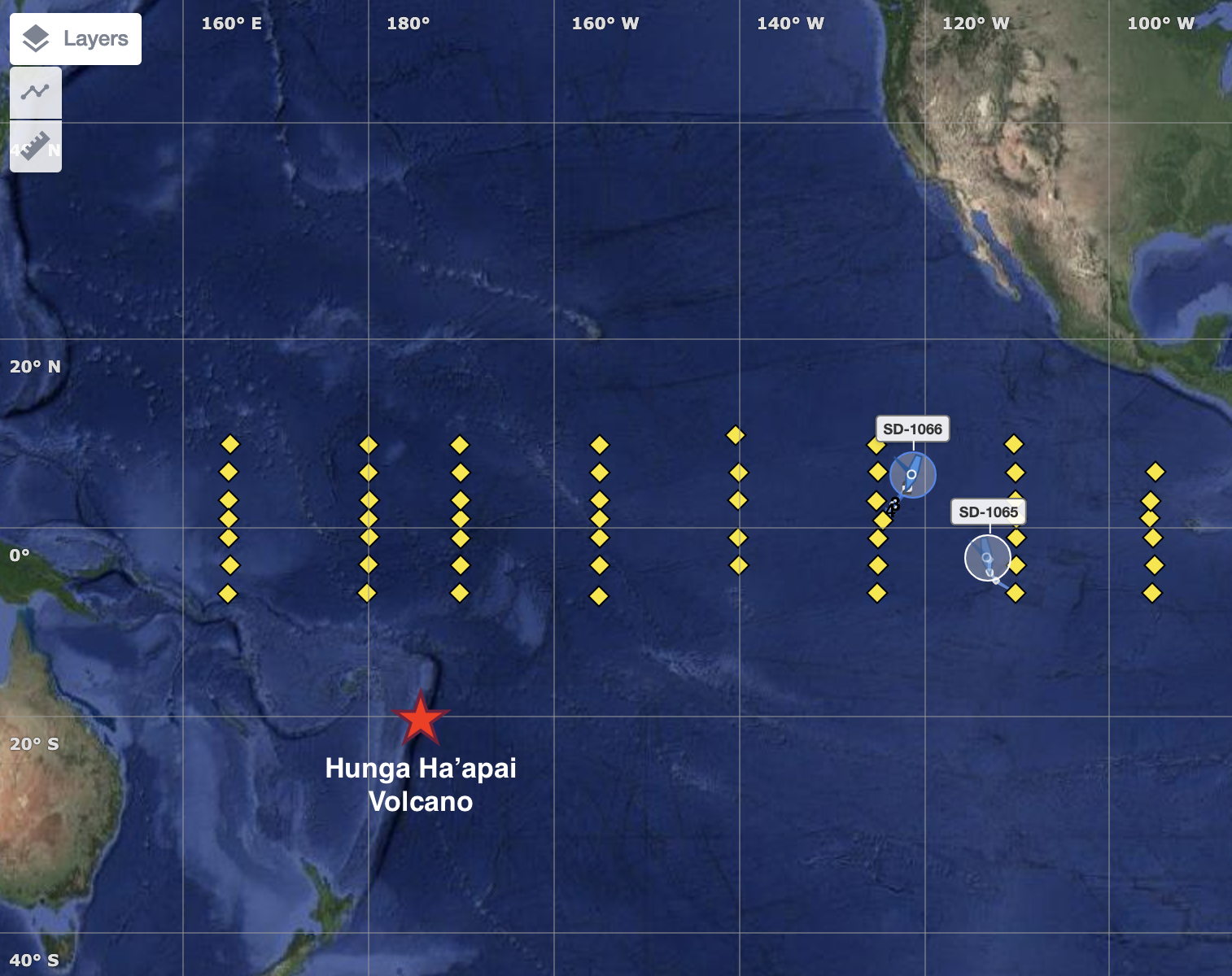
Map of the tropical Pacific showing the positions of saildrones 1065 and 1066 relative to the Hunga Ha'apai Volcano located in the Pacific island nation of Tonga, which is an archipelago consisting of more than 170 islands. TAO buoy locations (yellow diamonds) are included for reference.
The 2021 Tropical Pacific Observing System (TPOS) Saildrone Mission continues into its final month, with two Saildrone Uncrewed Surface Vehicles (USVs) traversing the northern and southern hemispheres in the eastern tropical Pacific between 125°W and 110°W. Six days ago, on January 15, 2022, approximately 3500 nautical miles (~4028 miles) to the southwest of drones 1065 and 1066, the Hunga Tonga-Hunga Ha'apai volcano erupted off the coast of Tonga in the South Pacific Ocean, triggering tsunami warnings around the world. Roughly 6 hours after the volcanic eruption, drones 1066 and 1065 recorded brief jumps in atmospheric pressure of almost 2 millibars at 10:20 and 10:45 UTC, respectively (see Saildrone's twitter post). Pressure jumps were also recorded by Deep-ocean Assessment and Reporting of Tsunamis (DART) systems that are strategically deployed by NOAA and international partners throughout the Pacific Ocean to detect tsunami waves and send data in real-time to tsunami warning centers. This signal was associated with a pressure-wave produced by the explosion, preceding the tsunami wave train that reverberated across the globe. Barometric pressure, at present, is a standard measurement on only a few TAO buoys, none of which were in operation during this event. But with the drones located in the eastern tropical Pacific for the ongoing TPOS mission, we were able to capture crucial, high-resolution information associated with the remote volcanic activity in an observationally-sparse region of the ocean. More about the event can be found on PMEL's Tsunami Research page.
Serenity at Sea
October 21, 2021
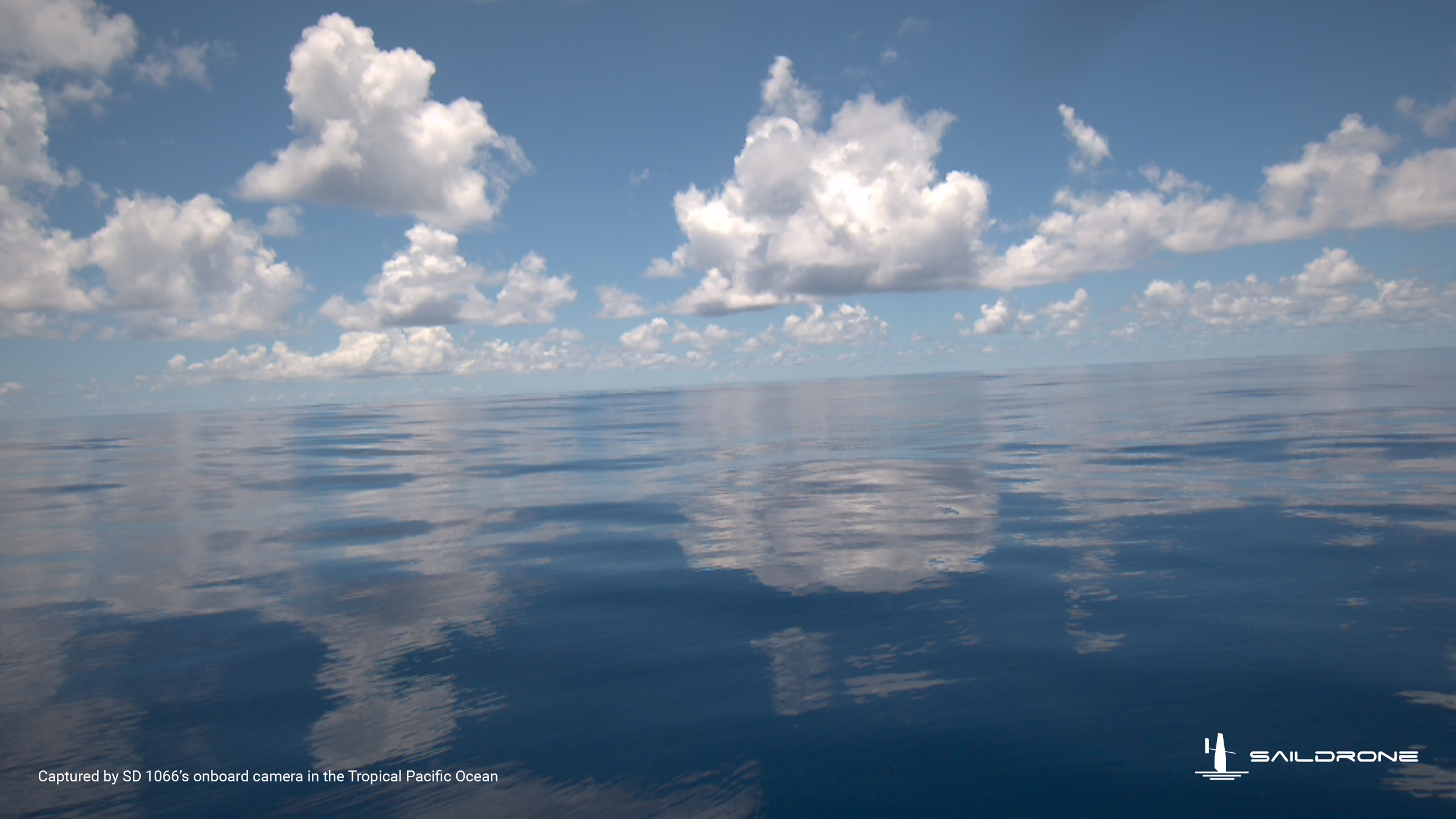
Saildrone vehicle 1066 entering the eastern tropical Pacific hurricane genesis study region.
The journey to the eastern tropical Pacific hurricane genesis study region involved weak winds and clear skies, leading to the idyllic photo taken by Saildrone vehicle 1066 on September 14, 2021. With wind speeds less than 1 knot (or less than 0.5 m/s), the ocean surface was calm and serene, capturing the overlying cloud field in its reflection. Unfortunately, these calm environmental conditions slowed the progress of the drones for a few days, limiting their eastward travel within the study region. Nevertheless, the drones were rerouted south into more favorable conditions and arrived at the 8°N, 110°W TAO mooring on October 1, 2021, initiating a series of buoy intercomparisons along the 110°W TAO line. The drones recently finished an intercomparison at the 5°N, 110°W mooring and are now headed to the Equator to begin the next phase of the mission.
The Eye of the Storm
August 24, 2021
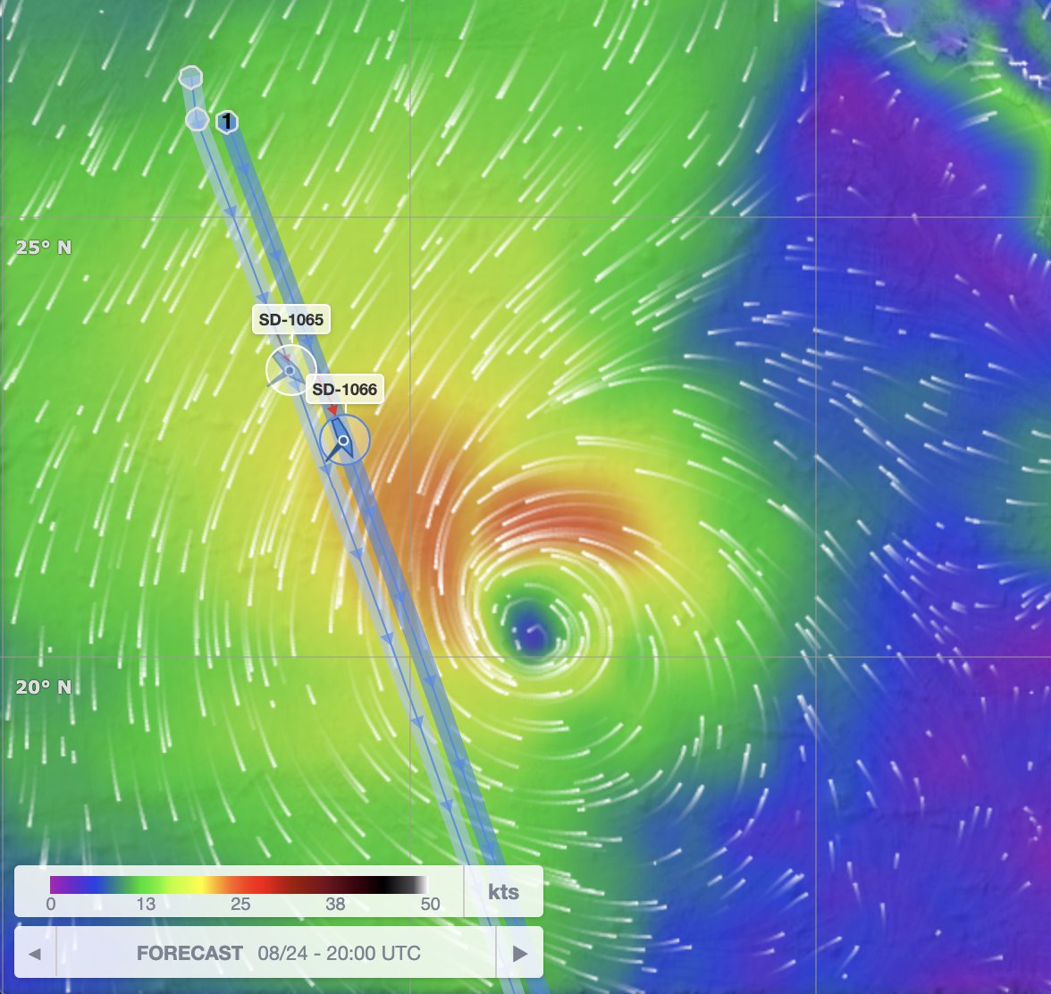
Map of current Saildrone tracks relative to the location of TD Marty on August 24, 2021. Wind speed and direction are shown in units of knots (nautical miles per hour).
Having spent ~1 month at sea, the two Saildrone USVs are quickly approaching the designated study area within the eastern tropical Pacific hurricane genesis region. It has been an active season of tropical storm activity so far, the most recent of which includes Tropical Depression Marty located around 20N, 118W. As the drones continue along their tracks, they will encounter TD Marty with wind speeds of up to 35 mph. The drones will enter into "storm mode" as they ride out the rough seas for the next few days.
And Away We Go!
July 26, 2021
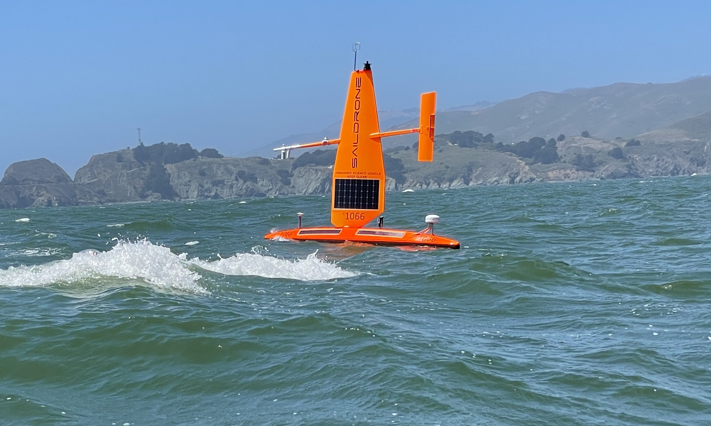
Saildrone vehicle 1066 off the coast of California. Photo Credit: Saildrone, Inc.
On July 23, 2021, two Saildrone uncrewed surface vehicles (USV) left San Francisco Bay to travel to the eastern tropical Pacific hurricane genesis region. As the western U.S. experiences record shattering heat waves and mega droughts, the eastern tropical Pacific started its 2021 hurricane season with the earliest tropical storm (Andres) on record going back to the early 1970s. The eastern tropical Pacific is a key region for hurricane genesis and El Niño Southern Oscillation (ENSO) development. The ENSO cycle not only modulates hurricane genesis in the eastern tropical Pacific and the tropical Atlantic, but also affects the global marine ecosystem and weather patterns on land. The hurricanes and tropical cyclones (TCs) generated in the eastern tropical Pacific, whether or not they make landfall, control the critical source of moisture for rainfall, especially over western North America. This region, however, is a gap in the Tropical Pacific Observing System (TPOS).
The two saildrones enroute to the eastern tropical Pacific will test how USVs may be used to address gaps in the present TPOS. The ~5-month mission will target several phenomena including: (1) Air-sea interactions and convective development in the eastern Pacific hurricane genesis region; (2) Air-sea interactions, including CO2 outgassing, in the equatorial upwelling zone; (3) Wind convergence in the southeastern Inter-Tropical Convergence Zone (ITCZ) between 2°S and 5°S, often referred to as the "double ITCZ" region due to common biases of this phenomenon in models; (4) Air-sea interactions in the frontal zone north of the cold equatorial upwelling; and (5) Contrasting subtropical and tropical oceanic and atmospheric states in the eastern Pacific.
Please stay tuned for more updates on the TPOS 2021 Mission!
This blog page is maintained by Samantha Wills.


