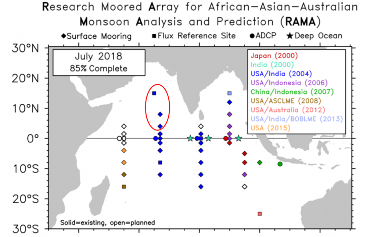
The recent Research Moored Array for African-Asian-Australian Monsoon Analysis and Prediction (RAMA) cruise aboard the NOAA Ship Ronald H. Brown, which departed Goa, India on June 14, established three new RAMA sites in the Arabian Sea along 65E and 67E. The cruise also maintained five existing RAMA moorings along 67E and finished on July 19 in Darwin, Australia.
RAMA was designed to study the Indian Ocean’s role in the monsoons. One third of the world population depends on monsoon driven rainfall for agricultural production, so improving our understanding and ability to predict the monsoons has been a longstanding objective of the international scientific community.
RAMA, the newest tropical moored buoy array (the other two being in the Pacific and Atlantic Oceans), was initiated in the traditionally data sparse Indian Ocean in 2004 via multi-national partnerships led by NOAA/PMEL. The new moorings bring RAMA to near completion and will help NOAA and other weather forecast centers around the world continue to improve monsoon predictions.


