

What's New
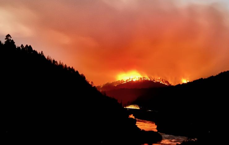
The Rum Creek fire burns vigorously after sunset near Merlin, Oregon on August 28, 2022. Credit: Robert Hiatt, NOAA National Weather Service
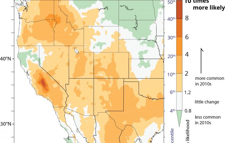
This graph shows how the frequency of nights with dry fuels predisposed to burning has increased between the 1981-2000 period and the 2011-2020 period. This has created the conditions for increased fire activity at night, a time when firefighters could once count on falling temperatures and rising humidity to give them a break. Credit: Pacific Marine Environmental Laboratory.
For decades, firefighting crews counted on falling temperatures and rising humidity at night to dampen wildfire activity, allowing them to rest, regroup and prepare for the next day.
Over the last 20 years though, satellite measurements have confirmed a change reported in the western US by firefighters on the ground: a dramatic increase in nighttime fire activity by larger fires. Previous studies attributed the increase to warmer, drier nights, conditions that help to maintain the flammability of fuels.
New research from NOAA, the University of Washington and the U.S. Forest Service has investigated other weather conditions that influence fire behavior, the extent to which these factors have been changing over recent decades and how they may have contributed to changes in nighttime fire behavior.
"We looked for simultaneous changes in winds, atmospheric mixing and fuel moisture that might enhance nocturnal fire activity," said lead author Andy Chiodi, a University of Washington scientist working with NOAA’s Pacific Marine Environmental Laboratory. "Our... more
PMEL in the News
Washington's coastal communities face a significant threat from tsunamis, with potential water heights reaching three stories in some areas following an offshore magnitude 9.0 earthquake.
Was the infamous "bloop" a sea monster? Learn why this noise was a good reminder that we should keep an eye on the South Pole.
Experts said they were "blind" to the Indian Ocean tsunami in 2004. Twenty years later, working toward a world without tsunami deaths is a challenge.
Feature Publication

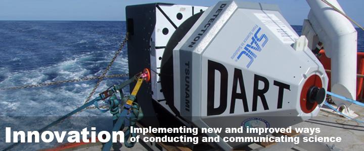
Uncrewed Surface Vessels, like this Saildrone, offer a cost-effective way to greatly increase ocean observations. Credit: Saildrone.
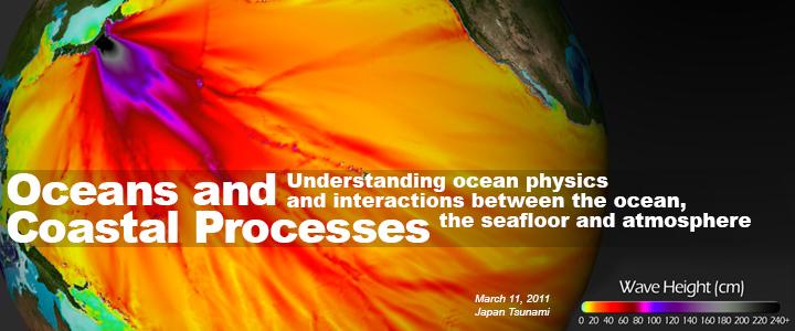
The global ocean covers 71% of the planet. Across these vast spaces, interactions between the ocean and atmosphere are primary drivers of Earth's weather, climate and marine productivity.
Satellites, instrumented moorings, and infrequent... more