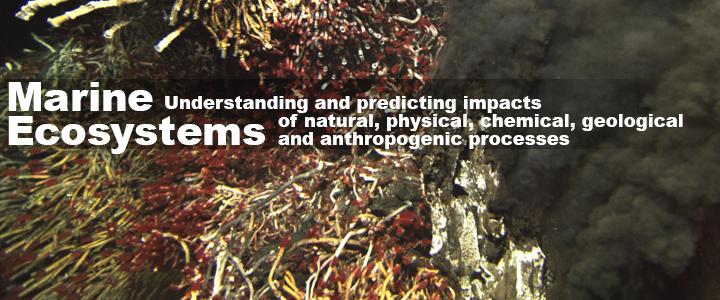
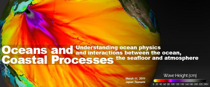
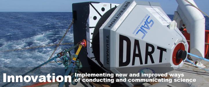
Follow the Saildrone 2016

Follow the Saildrone 2016

We launched! Join the adventure!

Be part of the team and experience what it is like to send a new method of research through some of the harshest seas on the planet to understand the ocean environment in a new and exciting way. Questions!? Email us! And we'll post your Q&A right here. 


04 SEPTEMBER 2016- Saildrone Inc. and our mission are featured in today's New York Times Technology section. Read the story here

03 SEPTEMBER 2016 - Both Saildrones have safely been recovered!  Both seem to be in good condition and are mechanically perfect and fully operable. One vehicle has experienced more growth than the other and the wind sensor one is broken clean off! Thanks for following along and keep posted for upcoming events and preliminary results in the weeks and months to come.

Sd_126_09_03_2016.jpeg


Sd_128_09_03_2016.jpeg


Sd_128_09_03b_2016.jpeg


01 SEPTEMBER 2016 - Arriving back to Dutch Harbor in the next few days, we have concluded this years mission! The science gear is turned off and the vessels are focusing on safely navigating to port. The two Saildrones have each traveled almost 3000 nautical miles in 101 days!

19 AUGUST 2016 - A view from Saildrone 128.

https://client.saildrone.com/media/sd-128/images_1471564933.jpeg

15 AUGUST 2016 - We are currently completing the fur seal grid and nearing the completion of our mission. With 18 more days until recovery in Dutch Harbor we have just about 550 more nm to cover. No more updates are available on the fishery acoustics; however, it is of interest that 80% of the foraging trips of the fur seals have been within 80% of the predicted use grid. For those not foraging in the grid, there was a spurt of easterly feeding early on, however, feeding has now moved to north of the grid. This area is typically foraged in mid to late September, so it is uncertain what fish is present here and why these animals are moving this far north so early. Fur seals primarily feed on age-0 pollock if there is abundance, however, if there is not a strong presence, they will move and feed on larger pollock.

Fur Seal tracks 2016

Fur Seal data provided by C. Kuhn (NOAA/AFSC) and is preliminary. Permission should be obtained to use this material in any capacity.

05 AUGUST 2016 - A cloudy and rainy view from Saildrone 128.

https://client.saildrone.com/media/sd-128/images_1470426731.jpeg

01 AUGUST 2016 - Below is an echogram showing pollock schools observed with the echosounder equipped Saildrone on the Bering Sea shelf June 23.  The seafloor is at a depth of ~125m, and can be seen as a red band.  The wind speed was 15 knots while Saildrone is moving at ~2 knots.

Echogram from Saildrone 23 June 2016

Echogram with pollock from Sd-126

27 JULY 2016 - Scientists Carey and Jeremy just returned from tagging in the field. Below is a peek into our internal Saildrone interface where we can see the track of Sd-126 (working NW) and the recently tagged fur seals (red and green circles and track lines). Red indicates the seal that will eventually be the followed individual. As the season progresses, they can adjust the survey grid to ensure sampling of the feeding areas that our tagged fur seals are using.

07_27_FurSeal Tracks

07_27_Fur Seal Tracks, by Saildrone/PMEL


26 JULY 2016 - A view from Saildrone 128.

https://client.saildrone.com/media/sd-128/images_1469493440.jpeg

25 JULY 2016 - A sunset view from Saildrone 128.

https://client.saildrone.com/media/sd-128/images_1469458349.jpeg

20 JULY 2016 - As of July 20th, both platforms are conducting fur seal studies. Sd-126 is running the fur seal grid working NW and Sd-128 will begin running a fur seal grid ~22 July, working SE. The Sd's have done speeds of 2-3 knots, with wind up to 20 kn. It is evident that summer progresses as th temperature of the water continues to rise. The below data show temperature of the surface waters for both of the Saildrones throughout the mission.

07_20_Temperature_Cokelet

Temperature data provided by N. Cokelet (NOAA/PMEL) and is prelimary. Permission should be obtained to use this material in any capacity.

19 JULY 2016 - We have just completed the echosounder Dyson comparison phase of the mission and are now moving onto the fur seal tracking. Sd-126 and the NOAAS Oscar Dyson ran a successful comparison on 07-10-16 where the NOAAS Dyson followed the Saildrone for 50 nm in wind conditions ranging from 7-20 kn. Below, a photo taken by researcher Alex DeRobertis during the successful comparison on 07-19-16 where the Dyson followed the Saildrone for 44 nm in wind conditions ranging from 15-25 kn. 

Sd at sea 2016

Saildrone at sea 2016

18 JULY 2016 - A view of St. Paul Island during the echosounder repair.

St. Paul Island 2016

St. Paul Island 2016

16 JULY 2016 - Our fur seal team at work on St. Paul Island. Read more about their annual tagging research here.

Fur Seal team at work 2016

Fur Seal team at work 2016

14 JULY 2016 - A view of St. Paul island from Saildrone 128 as she arrives for maintenance. Sd-128 was tied to the dock in St. Paul and did not move from 14 July 2016 03:37 to 23:41 UTC while the echosounder was repaired.

https://client.saildrone.com/media/sd-128/images_1468521366.jpeg

10 JULY 2016 - A view from Saildrone 126 of the NOAA Ship Oscar Dyson during vessel to saildrone comparison studies on the fish acoustic system. 

https://client.saildrone.com/media/sd-126/images_1468111523.jpeg

08 JULY 2016 - Another rainy day view from Saildrone 128. Both of the platforms remain south of St. Paul Island. The data show sd-126 encountered elevated chl a levels (10 microg/l) with increased O2 saturation - indicating a bloom, between St. Paul and St. George Islands. The Saildrones continue to travel around 2 knots with winds up to 15 knots.

https://client.saildrone.com/media/sd-128/images_1468015871.jpeg

01 JULY 2016 - A view from Saildrone 126. Sd-126 has reached mooring 'M4' and Sd-128 is near the shelf break, abreast of St. Paul Island. Salinity has risen for sd-126 as it sailed from the vicinity of St. Paul Island to M4. The speed over ground has slowed below 1 kn because the wind speed has dropped.

30 JUNE 2016 - The two Saildrones continue northwestward, bracketing the Pribilof Islands. Salinity is greatest in the Bering Sea basin at sd-128 and least on the shelf at sd-126 that is affected by sea-ice melt.  The Outer Front separates the basin from the shelf at the shelf break, and one can see the large salinity gradient there especially at the latitude of the Pribilof Islands. The Outer Front is not so well demarcated by temperature because there is little thermal contrast between the basin and the outer shelf. 

24 JUNE 2016 - A view from Saildrone 128.

19 JUNE 2016 - 19 June has lowest daytime PAR, probably owing to clouds, yet measured on this mission. 

16 JUNE 2016 - A view from Saildrone 126. The two Saildrone are now split apart, 126 is north and over the shelf, while 128 is heading south and past the shelf to deeper water. The water is warmer at sd-126 while salinity at sd-128 at the shelf edge exceeds that of sd-126 on the shelf. 

10 JUNE 2016 - A view of a fishing boat from Saildrone 128.

03 JUNE 2016 - A view from Saildrone 128, one of two Saildrone making their way to the PMEL oceanographic mooring site, M2, also known as 'Peggy'. The boats have been traveling almost 11 days now, and have covered over 200 nm.

23 MAY 2016 - Saildrone 128 is launched at 20:32:10 UTC from a small dock in Dutch Harbor, Alaska. The image below is from the Saildrone's four cameras while it is being hoisted into the water. From left to right: a. Saildrone 126 (our second vehicle for this mission) in it's cradle. b. The dock. c. sky. d. Saildrone 126 from a different angle.

20 MAY 2016 - Saildrones are in Dutch Harbor, AK. Awaiting launch! Where are we going this year? See the map below and visit PMEL's YouTube for a copy of our Press Release.

2016 Saildrone Mission Map

2016 Preliminary Saildrone Mission Map


19 MAY 2016 - Engineers and scientists gather to discuss the first phases of the mission.

IMG_7050.JPG