CGOA model with tidal nudging
Features of This Run
Results
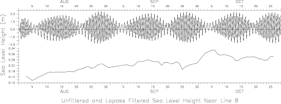
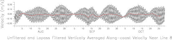
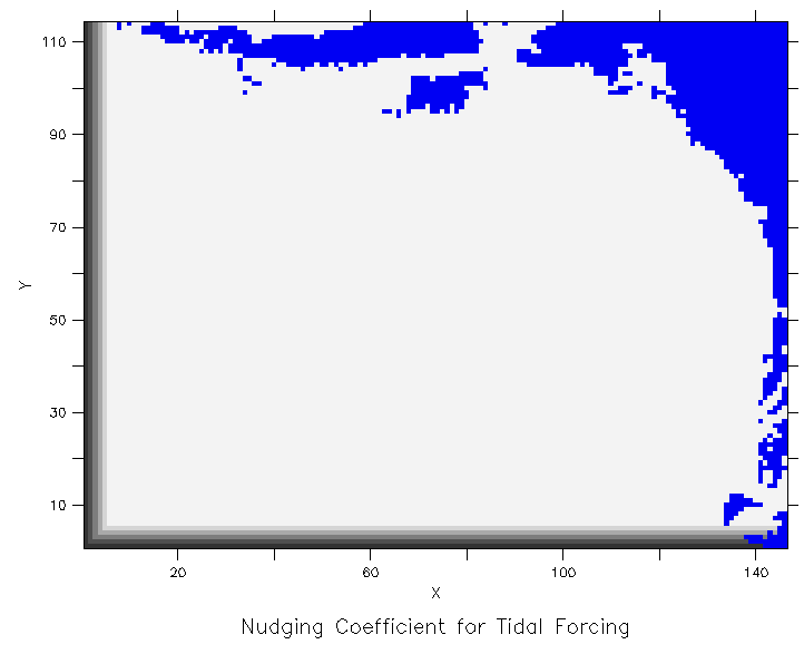
General Description of ResultsThe effects of tidal forcing are clearly evident in both hourly sea surface height and velocity. Though tidal nudging is restricted to the western and southern boundaries (see discussion below), tidal amplitudes are highest in the region of Cook Inlet, demonstrating realistic behavior within the modeled area. Line 8, refered to in the figure above, is at the western end of Shelikof Strait.Tidal NudgingTidal sea surface heights were produced by a one-month run of the global circulation model (SEOM), implemented in 2-D form with realistic bathymetry and forced with equilibrium tidal heights for five components - M2, N2, S2, K1 and O1.The total sea surface height from the forced SEOM run was harmonically decomposed into the amplitudes and relative phases of the five tidal components; these were interpolated to the SCRUM gridpoints. For each run of SCRUM, they are recombined into total tidal height using year dependent phase and amplitude relationships (Hal Mofjeld, personal communication) calibrated with tidal data from the Gulf of Alaska (in the basin, away from the slope and sea mounts). SCRUM's tidal nudging band has maximum nudging along the southern and western boundaries of the domain, linearly decreasing to zero within 5 gridpoints of the boundaries. SCRUM's sea surface height is nudged to the sum of total SEOM-derived tidal height plus daily-averaged subtidal sea surface height from a previously completed run of SCRUM with only subtidal nudging. The addition of the subtidal sea surface height is necessary to avoid discontinuities along the edge of the nudging band.
We are currently working on a cosine-Lanczos filtering process that will remove tidal signals from the output files, reducing the size of the files without the biasing effects of simple daily averaging. A description of our method of subtidal nudging can be found in the discussion of the runs nudged with climatology and subtidal barotropic velocities only. |