CGOA model with T, S, and velocity nudging
These results are featured in a manuscript submitted to Progress in Oceanography. Features of This Run
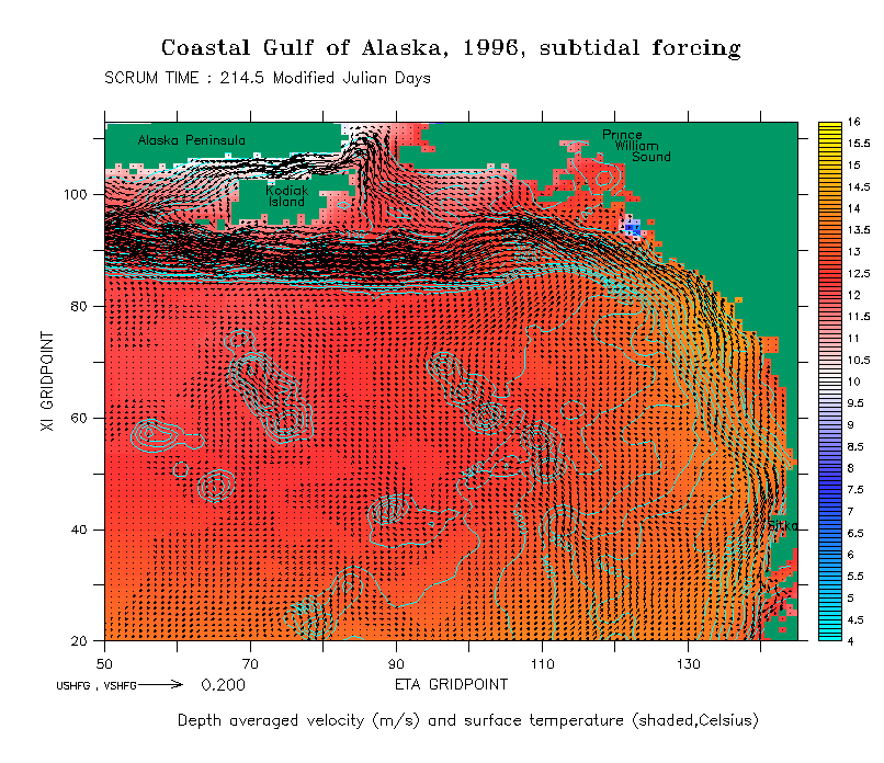
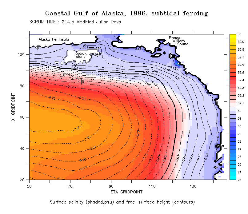
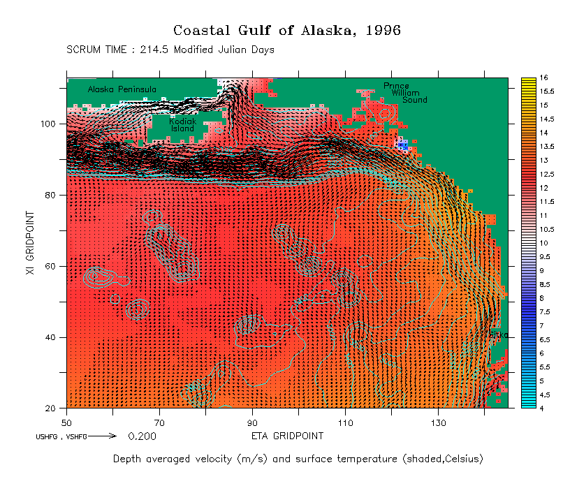
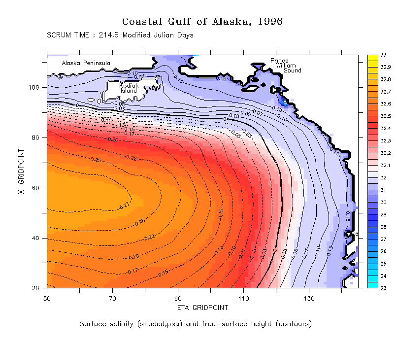
Results
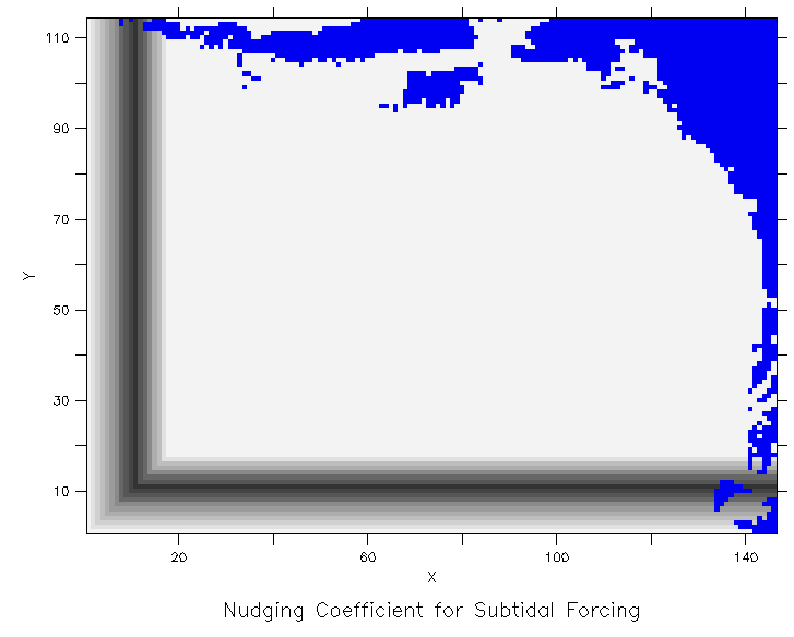
Subtidal Nudging SchemesWe tested two different nudging schemes. Both focused forcing in the telescoping regions that are south and west of the finely resolved region of interest.Experiment A began 5 days before the end of July when an initialization run was spun up with TS nudging to climatology and subtidal, barotropic U and V nudging to SEOM results over a region that included the entire finely resolved area, and extended to point 10 in the telescoping region, ramping to zero at the western and southern walls. A subsequent 90 day run began on August 1, using the initialization results as initial conditions. This run had a nudging area whose coefficient varied from 0 at walls, max nudgcoft (.1/86400) at point 10, and 0 again at edge of finely resolved area nudging TS and subtidal velocity. Experiment B was initialized on August 1 the same way that Experiment A was. During this 90 day run, TS was nudged in the nudging zone described above, but subtidal velocity was not. This run was intended as a basis from comparison for the continued nudging to SEOM results.
General Description of ResultsThe differences between the results of the two nudging schemes are small, except along the southeast slope. Features propagating into the region from the south are dissipated into the 200 km scale eddy field, rather than continuing to propagate along the shelf break through the whole domain. This dissipation might be due to the complex bathymetry in the region, or it may be that the model's 22 km resolution is not fine enough to faithfully reproduce Coastal-Trapped Wave dynamics. | ||||||||||||||