
Data Used in Coastal Gulf of Alaska Modeling Efforts
Freshwater Input
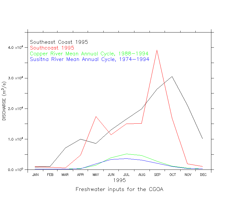
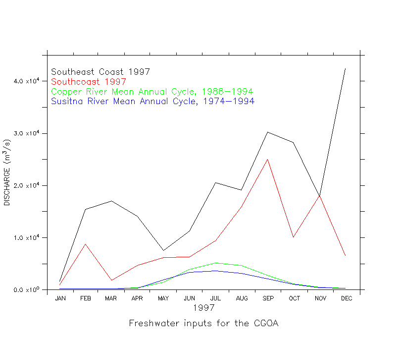
Southcoast and Southeast Coast discharge represent the integrated flux of freshwater input as derived from snowpack, precipitation and temperature data by Tom Royer , Old Dominion University. These data are available for the years 1933-1998. The Southeast Coast region begins at the southern border of Alaska and it extends northward to a location between Glacier Bay and Yakutat Bay. The Southcoast extends northward from there to include the southern side of the Kenai Penisula. These regions are roughly equivalent to 130W-141W and 141W-152W longitude. The river discharge data were obtained from the USGS. The Susitna and Copper Rivers were among the few that were gauged, but there were not many years of data for either. Therefore, a monthly climatology was computed with all the available data, and this will be used for every model year. Data were converted from ft^3/s to m^3/s. Note how little discharge is provided by these large rivers, as compared to the integrated discharge. NCEP/NCAR Reanalysis Heat Flux and Wind Stress
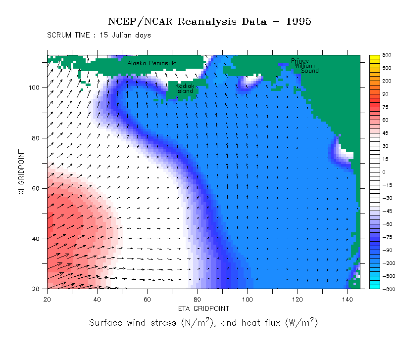
The NCEP/NCAR Global Reanalysis Project is an effort to create a global data set of atmospheric variables by combining a global spectral model with historical data. The model has been run for the years 1958-present, and the output is available online. Resolution of these data is roughly 2 degrees, but it varies since the model uses a T62 Gaussian grid with 192x94 points. Temporal resolution is 6 hours, but we have chosen to use their daily averages.
Daily average data for latent and sensible heat net flux, and net longwave and
shortwave radiation in W/m^2 were downloaded separately, multiplied by -1,
and summed to provide total heat flux from the ocean. For SCRUM, positive is
downward flux and heating of the ocean.
Daily average U-wind and V-wind at 10m in m/s were
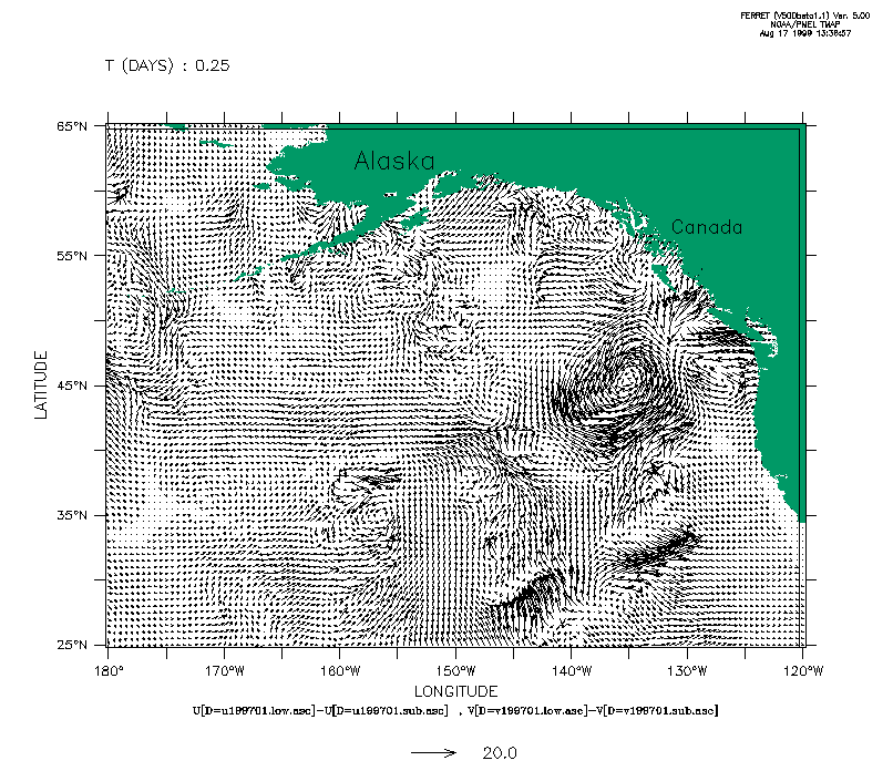
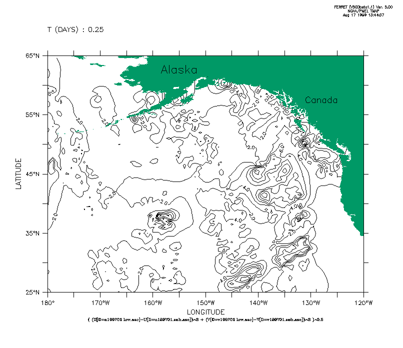
downloaded, and windstress was computed from them using the formula: NSCAT Wind Stress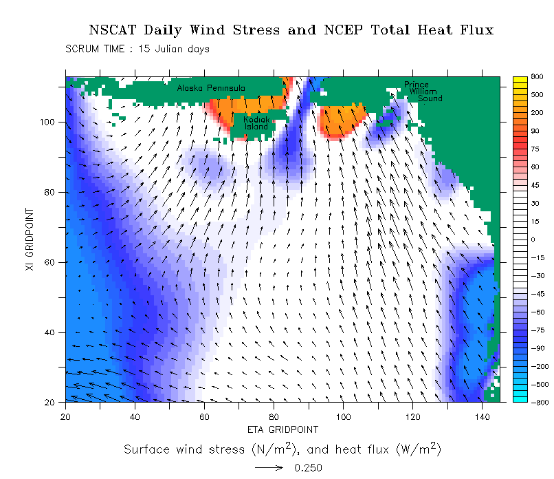 Click image to start animation These winds were derived from NSCAT satellite measurements of ocean roughness. NSCAT data is of high quality, but is spotty in space and and time (the NSCAT satellite flew from Sept. 15 1996 to June 29, 1997), so to create a year-long, global, gridded data set, it was suplimented with data from other sources. The year-long record begins with data from the ERS-2 satellite in September, 1996, switches to NSCAT data when they became available, then switches back to ERS-2 for July 1997; shorter temporal gaps in the NSCAT record were also filled with ERS-2 data. Spatial gaps between the satellite tracks were filled with NCEP/NCAR Reanalysis data. Several different methods were used to blend the track data with the global data set; we used the results of two of those methods: a blending method based on the wavelet method of Chin, (BLN) and a substitution method where the satellite data was simply substituted for the Reanalysis data (SUB). Data falls on a 0.5x0.5 degree grid from (0.5E,88S) to (360E,88N), every 6 hours. We received the data already processed from NCAR mass storage. The SUB data, examined on the original grid, are substantially different from the Reanalysis data alone, especially along the coast (see animations below). However, we chose to use the BLN data to avoid horizontal discontinuities. To conserve disk space, I created daily averages of these data, then interpolated them to the CGOA grid. After all this, the influence of the NSCAT data is almost totally obscured, and there is little difference between it and the Reanalysis data. In the end, this fact, and the limited time period available, led us to choose the Reanalysis winds for our primary wind forcing.
Bathymetry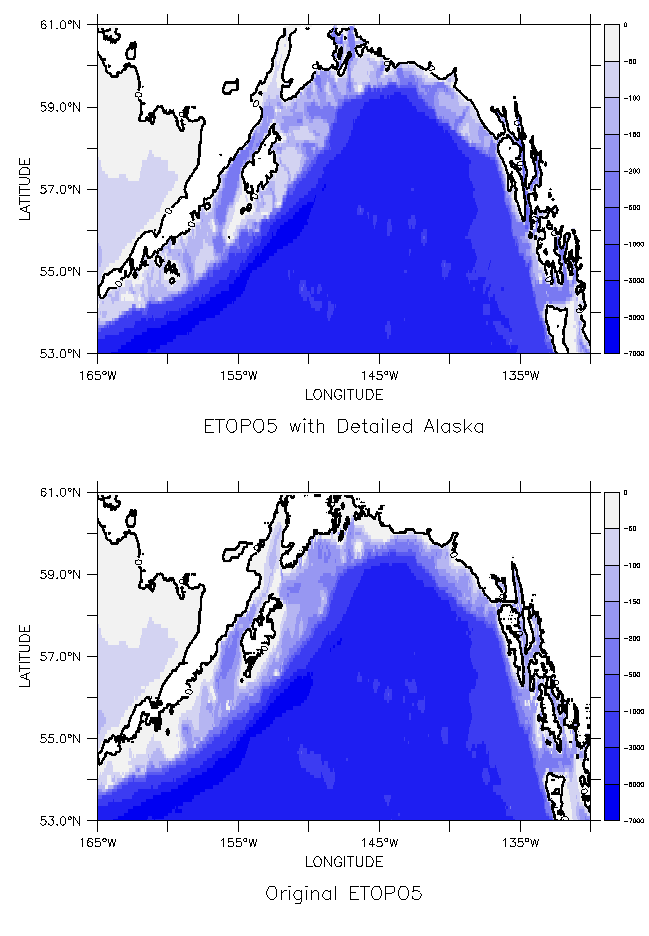 Data for the detailed bathymetry map of the Gulf of Alaska was obtained from 2 different sources. Data from the National Ocean Service (NOS) Hydrographic Data Base were error checked and gridded to 30 seconds by National Geophysical Data Center (NGDC) and distributed as the TerrainBase data collection. These data are focused on specific coastal areas such as Cook Inlet, so for general offshore areas a second data set was needed. Smith and Sandwell (1997) collected and verified coastline and marine ship track data from many sources, and distributed that data as part of their 2 minute measured and estimated digital topographic map. Though their estimated bathymetry contains too much noise to be useful on the continental shelf, the measured bathymetry was easily extracted and used. Data from these 2 sources were combined and interpolated to a 5 minute grid using Global Mapping Tools (GMT). To reduce computation effort, the interpolations were done for 10 deg. by 10 deg. areas that overlap by .25 deg. The interpolated grid points match those of ETOPO5 so that when they were combined, ETOPO5 seemlessly supplies data in areas where the detailed bathymetry data set is lacking (the Bering Sea, for example). The final data set is particularly accurate in areas of high data resolution, such as along the shelf break. It constitutes a major improvement over ETOPO5, especially in shallow shelf areas such as the Trinity Banks southwest of Kodiak Island. Improvements can easily be made in coastline definition as more digital data becomes available from NGDC. If you would like a copy of these data, contact me. I got information on available bathymetric data sets from Robert A. Kamphaus's (now defunct) web site. |


 http://www.pmel.noaa.gov/~dobbins/scrum_cgoa/data.html