What's New Archive
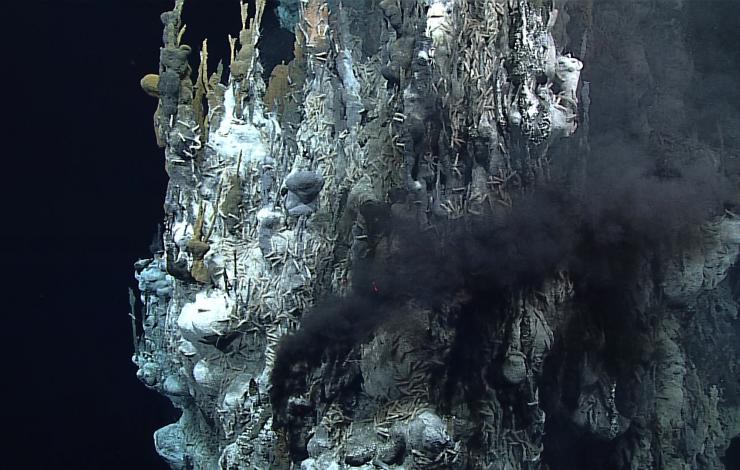
Image courtesy of NOAA Office of Ocean Exploration and Research, 2016 Deepwater Exploration of the Marianas.
EOI scientists participated in several ROV dives remotely via "telepresence" during the 2016 Deepwater Exploration of the Marianas expedition by the NOAA ship Okeanos Explorer. During Leg 1 of the expedition, EOI co-led three dives in the Mariana backarc, exploring the site of a recent eruption and two newly discovered hydrothermal vent fields. All of these discovered during a recent cruise on R/V Falkor in Nov-Dec 2015, and set the stage for further exploration during a follow-on R/V Falkor cruise in December 2016. During Leg 3 of the Okeanos expedition, EOI co-led three dives in at three volcanically active seamounts, each with its own unique ecosystem. The expedition was supported by the NOAA Ocean Exploration and Research Program.
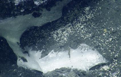
The Ocean Exploration Trust Inc. ship E/V Nautilus, with several NOAA-PMEL and Oregon State University CIMRS scientists aboard, is using the latest midwater sonar technology to map out methane seeps along the Cascadia continental margin this month. PMEL/CIMRS scientists report that, after locating extensive bubble plumes of methane in Astoria canyon at 850 m, the remotely operated vehicle Hercules visited the site and found an exposure of methane hydrate and gas bubbles streaming out of the seafloor. The hydrate, a mixed water/methane ice phase, is present over extensive areas of continental margins, but has only rarely been observed exposed at the seafloor along the Cascadia margin. Why the hydrate is exposed at this location in association with the methane gas seepage is a topic of discussion among the scientists aboard the Nautilus and those ashore participating remotely via the internet. The E/V Nautilus is a unique platform with extensive telepresence capability that enables scientist aboard to interact with those in the broader scientific community and the public ashore. Dives with the Hercules are broadcast live over the internet and can be viewed at http://www.nautiluslive.org
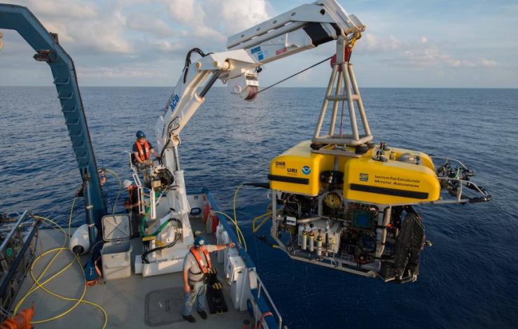
PMEL scientists from the Earth-Ocean Interactions Program will be on board the E/V Nautilus, which is operated by the Ocean Exploration Trust (OET), during June 1-20. This expedition will explore and characterize habitats and methane seeps along the Cascadia continental margin between northern Washington and Cape Mendocino. Broadband video of the seafloor during the dives from OET remotely operated vehicle Hercules will be broadcast in realtime over the internet. Scientists ashore representing a broad range of expertise will also participate via a realtime link to the ship during the dives.
Follow along live and learn more about the cruise on: http://www.nautiluslive.org
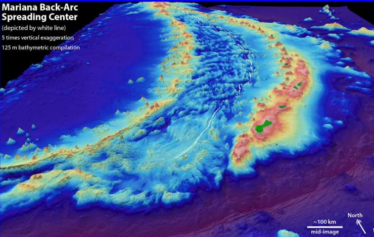
Mariana back-arc region with the white line depicting the spreading center.
EOI Scientists aboard the Schmidt Ocean Institute’s RV Falkor explored the Mariana back-arc spreading center (November 20 - December 17) and discovered four new hydrothermal vent sites. Researchers from NOAA and its cooperative institutes at the University of Washington and Oregon State University searched for these new hydrothermally active sites to gain a better understanding of the physical, chemical and geological forces that shape the biodiversity in these unique ecosystems. Scientists will return for a second cruise in the Fall of 2016 with a remotely operated vehicle to further characterize and sample the new vent sites.
Learn more about the expedition at:
Hydrothermal Hunt at Mariana (Schmidt Ocean Institute)
UPDATE May 2016: EOI scientists remotely join expedition verifying new hydrothermal vents and lava flows with ROV expedition aboard NOAA Ship Okeanos Explorer. Read more here.
The Schmidt Ocean Institute provided the ship and support for this expedition. Additional support is provided by NOAA Office of Ocean Exploration and Research and NOAA Pacific Island Regional Office.
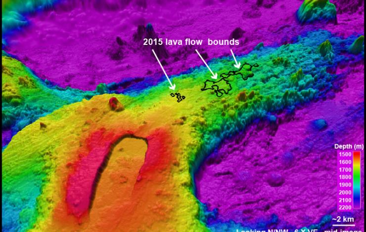
3D view of Axial Seamount's caldera and the 2015 lava flow on the north rift zone.
The 2015 expedition to Axial Seamount was August 15-29 aboard the R/V Thompson. The cruise successfully conducted operations with the underwater vehicles ROV Jason and AUV Sentry. The big excitement this year was exploring the April-May 2015 Axial Seamount eruption and conducting extensive exploration, mapping, and sampling of the new lava flows. Explore the results of the expedition with the Axial 2015 blog (axial2015.blogspot.com).
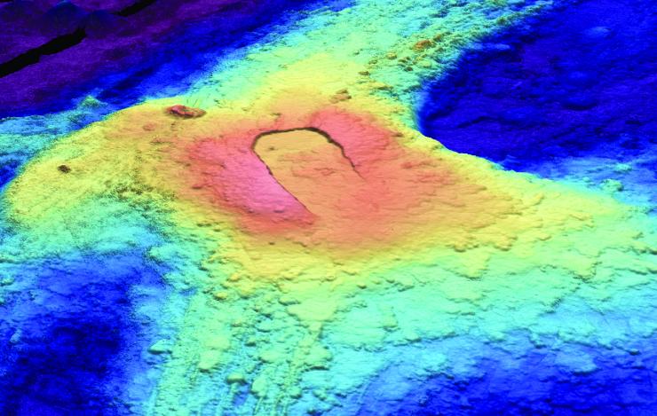
3D view of Axial Seamount, 300 miles off the coast of Oregon and Washington.
An eruption appears to have started at Axial Seamount on April 24. The eruption was forecast in September 2014 to occur by the end of 2015, based on seafloor pressure measurements. Axial Seamount is the most active submarine volcano in the NE Pacific and the site of the new OOI cabled observatory. More information on the eruption forecast is HERE, and live data from the seafloor is displayed HERE.