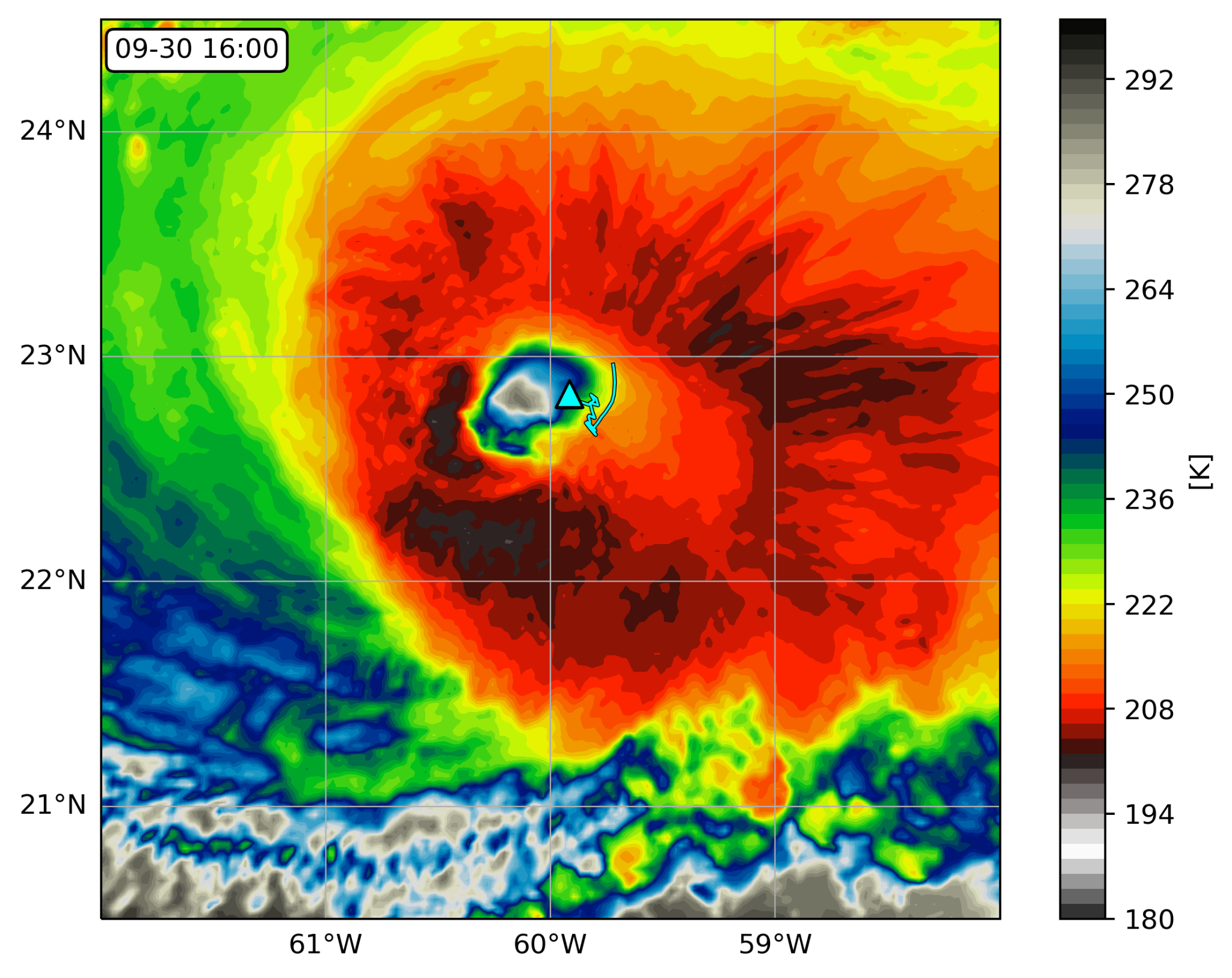
Saildrone 1045 location (triangle) overlaid on an infrared image from NOAA geostationary satellite (colors) at 16:00 UTC September 30, 2021. The saildrone track (light blue line) starts at 04:00 UTC on the same day. Courtesy of Edorado Mazza/University of Washington.
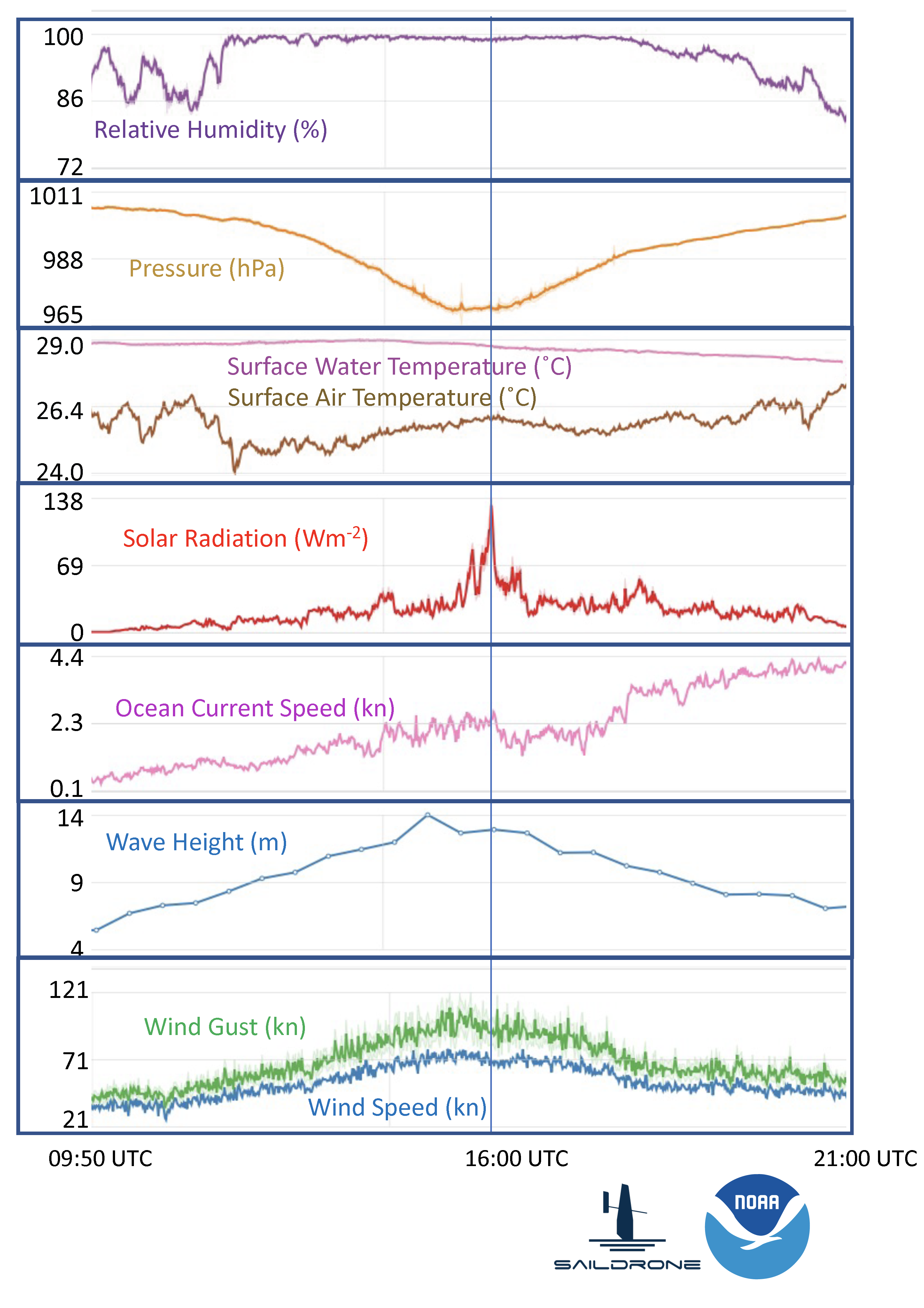
Time series of saildrone measurements of wind, humidity, pressure, current speed, wave heights and solar radiation on September 30, 2021. Vertical line marks the time when the saildrone was located inside the eyewall of Hurricane Sam. Click on image to view all the variables.
Saildrone 1045, one of the five drones PMEL and AOML deployed in the western Atlantic was steered into position to intercept Category 4 Hurricane Sam on September 30, 2021 to record critical data. The encounter required precise interpretation of hurricane forecasts and tight collaboration with Saildrone pilots. The saildrone measured one-minute sustained wind speeds of up to 90.6 miles per hour (40.5 m/s) with wind gusts up to 126.5 mph (56.5 meters/second), waves exceeding 46.4 feet (14.2 meters), and saturated air near the surface. The saildrone was in the hurricane eye next to the eyewall at 16:00 UTC / 12:00 EDT and was in sustained hurricane-force winds (at least 75 mph) for about two hours straight. The first ever drone camera images and video show a large amount of sea spray from the ocean surface and are a frightening display of the power of tropical cyclones.
This is the first time that sea surface conditions near a hurricane eye were observed by an uncrewed surface vehicle. Its success is built upon years of partnership between NOAA and Saildrone, Inc. with testing in progressively more hostile environments and 5 years of innovative engineering on the platform, sensors, and data processing, months of preparation leading to the deployment, and dedicated efforts of operating saildrones by the NOAA science team and Saildrone pilots during the deployment. An animation created by scientists at NOAA AOML shows how the saildrone was positioned to intercept Hurricane Sam alongside saildrone observations of Hurricane Sam.
Prior to hurricane Sam, the NOAA saildrones also measured tropical storms Peter (9/21/2021), Henri (8/20/2021), Grace (8/17/2021) and Fred (8/13/2021). Read more about these encounters on the mission blog: https://www.pmel.noaa.gov/saildrone-hurricane2021/mission_blog.html
Read more on NOAA.gov: A world first: Ocean drone captures video from inside a hurricane