P16N
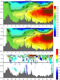
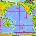
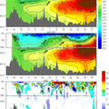
The R/V Thomas G. Thompson conducted the P16N hydrographic survey in the Central Pacific Ocean, nominally along 151°W between 17°S and 21°N, from 13 February to 3 March 2006. Thirty-four scientists from 11 academic institutions and two NOAA laboratories participated in the cruise. Full-depth CTD/rosette/LADCP casts were collected every 60 nautical miles. Water samples were collected at 34 depths at each station and analyzed for salinity, nutrients, dissolved oxygen, four inorganic carbon parameters, radiocarbon, dissolved organic matter, colored dissolved organic carbon, chlorofluorocarbons, helium/tritium, oxygen isotopes, chlorophyll, and a suite of bacterial measurements. Trace metal casts to 1000m were conducted at approximately every other station. Optical profiles were collected once each day. Near surface seawater and atmospheric measurements were also made along the cruise track. The last of the 43 stations were completed on Thursday 2 March, 2006. No major problems were encountered on the cruise and all major cruise objectives were achieved.
Carbon Data
CTD and other hydrographic data
WOCE section designation: P16N_2006
Chief Scientists Leg 1: Christopher L. Sabine and Erica Key
Chief Scientists Leg 2: Richard A. Feely and Sabine Mecking.
Dates: 13 FEB 2006 - 3 MAR 2006 leg 1, 10 MAR 2006 - 30 MAR 2006 leg 2
Ship: R/V Thomas G. Thompson
Ports of call: Papeete, Tahiti - Honolulu, HI USA leg 1, Honolulu, HI - Kodiak, AK USA leg 2
Number of stations: 43 leg 1, 41 leg 2
Geographic boundaries: 21°N to 17°S by 150°W to 152°W leg 1, 56°17'N to 22°N by 152°W to 153°13'W leg 2


