Coastal Observation Network
PMEL scientists in collaboration with colleagues to build a carbon observatory in the coastal oceans
PMEL scientists are working with colleagues both within and outside of NOAA to design and implement a carbon observation network in North American coastal oceans. This observatory will have two major objectives: 1) to improve our ability to estimate air-sea carbon fluxes in the coastal oceans and 2) to allow us to assess and monitor ocean acidification in the coastal oceans. The backbone of the coastal carbon observatory will initially emphasize three platforms for measuring inorganic carbon - moorings, ships of opportunity (research and commercial vessels), and ship-based cruises. Other technologies under development that we anticipate being of routine use in the coastal carbon observatory in the future include towed sensor packages, gliders, and floats. Currently, PMEL plays an active role in developing the West Coast carbon observation network, as well as in the deployment of moored carbon sensors along the East, Gulf, and Alaskan coastlines in the U.S.
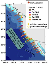
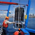
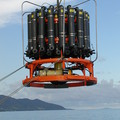
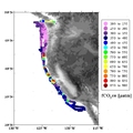
The major features of the existing (and planned) West Coast carbon observatory are shown in the figure above (left). Ship-based observations include regional cruises led by colleagues at the Institute of Ocean Sciences (IOS), Northwest Fisheries Science Center (PacOOS), the Monterey Bay Aquarium Research Institute (MBARI), CalCOFI, and IMECOCAL, each of which covers a portion of the West Coast from British Columbia to Baja California. PMEL has on-going collaborations on topics related to coastal carbon cycling and ocean acidification with each of these groups, but does not lead any of the regional cruises. Regional cruises occur on monthly to annual time scales and generally involve sampling dissolved inorganic carbon and total alkalinity at some or all of the stations occupied during each cruise. PMEL led a large-scale coastal cruise, linking all these sub-regions together, in May-June 2007, and will lead a similar cruise in Aug.-Sept. 2011; PMEL's goal is to conduct these large-scale cruises in alternate years if funding is available.
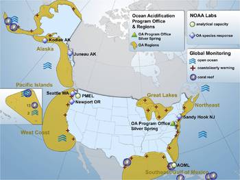
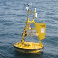
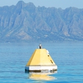
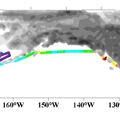
In addition, a growing number of moorings are deployed in the North American coastal oceans with at least one carbon sensor, as well as sensors for salinity, temperature, and other parameters, including oxygen, nitrate, chlorophyll, and turbidity (see both figures for full US coverage and a more detailed look at the West Coast). These moorings offer high temporal resolution measurements of these parameters so that the contribution of events such as blooms and storms to coastal carbon cycling and ocean acidification can be assessed.
A growing number of vessels of opportunity, including both NOAA ships and container ships, also collect surface seawater and air pCO2 data for PMEL's underway pCO2 program as these ships ply West Coast waters. More recently, a number of underway pCO2 data sets have been collected in Alaskan waters. All of these instrument packages are being upgraded to include high-quality oxygen and pH sensors to facilitate our understanding of the acidification of the surface waters along the northern and western margins of North America. PMEL's sister program at AOML maintains a similar number of underway CO2 systems on ships serving the East and Gulf coasts.
Finally, in subtropical and tropical coastal regions around the world, PMEL scientists are also contributing to the development of a global coral reef mooring network. These moorings have the primary objective of assessing the chemical conditions that coral reefs are experiencing as the oceans acidify and the current health and functioning of coral reef ecosystems in the face of these conditions.

